Mariners Island Follow-Up
On May 27 we did a follow-up woody debris survey on Mariners Island jointly with Eric Palm from Ducks Unlimited. The geo-referenced sample plots applied to the woody debris survey prior to the log removal in March were used. The reason for this second survey was to establish baseline data for future monitoring. The surveys will be repeated once/year in late spring in order to qualify and quantify potential log and woody debris build-up over the year.
OLYMPUS DIGITAL CAMERA
OLYMPUS DIGITAL CAMERA
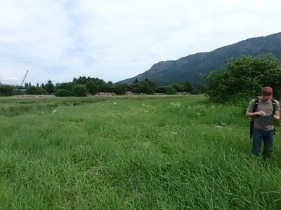
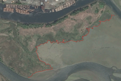
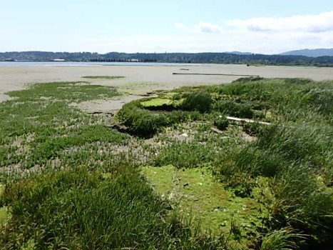
I was delighted to see how quickly vegetation has re-colonized the area that was cleared of logs. At current there is little sign of any soil disturbance which had been extensive as a result of the log removal as demonstrated by the following video-clip produced for this project.https://www.youtube.com/watch?v=EYeZV5wJjNk&feature=youtu.beThis is very encouraging and a clear indication of how resilient ecosystem are if given a chance to recuperate under the right framework conditions.We are currently preparing for a vegetation survey to take place in early July when flowering plants are easier to identify. Again we will be using the same geo-referenced sample plots in order to establish baseline information for the planned five-year monitoring program with focus on the assessment of vegetation recovery (species diversity and abundance). We expected to encounter a significant number of invasive/exotic species brought to the area in earlier years when Mariners Island was used for agriculture and cattle grazing. It remains to be seen whether native vegetation will re-colonize the disturbed sites on its own or whether an active intervention will be required in support of a healthy salt marsh.Shoreline MonitoringFollowing the woody debris survey on May 27 we produced a shape-file for way-points taken along the sea-exposed shoreline of Mariners Island, more specifically, the shoreline from the mill pond to the Cowichan River, using the outer extension of Juncus spec. (dominant species) communities as benchmark vegetation.The Google satellite image showing the geo-referenced shoreline was taken on April 17, 2015, three weeks after the log and woody debris clean-up. The photo clearly shows the extent of the area cleared of washed-up logs (light brown color). The rationale for establishing this baseline is to monitor shoreline changes over time. Salt marsh edge (i.e. where the sea meets the land) plays a Key role for erosion control. We noticed that parts of the shoreline have already been severely undercut by wave action de-stabilizing edge, whereas other sections show clear signs of colonizing uncus spec dominated plant communities. The monitoring of the geo-referenced shoreline will be continued over the coming years.


