Citizen Science: CERCA's cooperation with Cowichan Secondary Students
Citizen Science: CERCA's cooperation with Cowichan Secondary Students
What is "MABRRI"?
The Mount Arrowsmith Biosphere Region Research Institute (MABRRI) was established in 2014 by the Vancouver Island University (VIU). Its programs and research involves student- and faculty-guided nature-related research in cooperation with communities and Non-Government Organizations (NGOs). As aptly described on MABRRI's website, its mission is:
"...to advance a program of inquiry that involves regional stakeholders in meaningful explorations of issues of local relevance. By harnessing the knowledge of the MABR community and the interdisciplinary strengths of students and faculty at Vancouver Island University, MABRRI is a centre for collaborative research, innovation, and knowledge sharing that elevates the relationship between people and nature on Vancouver Island and within the Mount Arrowsmith Biosphere Region."
Forage Fish
CERCA recently joined one of MABRRI's projects with focus on forage fish spawning habitat monitoring involving students from the Cowichan Secondary School as part of the school's Environmental Stewardship Program. More than 20 grades 11 and 12 students are participating as part of the School's Environmental Science and Human Geography Curriculum. The project, led by CERCA's Co-Chair Dr. Bill Heath, took place in May and June with sampling of beaches in Maple Bay, Cherry Point and Cowichan Bay. Of special interest in this project are the identification of spawning time and location of Pacific sand lance and surf smelt, both of critical importance to the food chain from lower to upper trophic levels (Pacific salmon and Orcas). This project, which follows monitoring and inventory methods developed and used by the Washington Department of Fish & Wildlife, is expected to fill important data gaps by identifying active forage fish spawning habitat through the collection of sediment samples from locations with known favourable habitat characteristics. Samples collected by the students under guidance of Bill are processed by MABRRI, analyzing them for the presence of embryos. The results are shared with CERCA and the students ("citizen scientists"), ensuring their engagement throughout the entire process. Apart from CERCA, MABBRI is currently:
"...working with 9 citizen science groups to sample the 88 beach stations that are established along the Eastern coastline of Vancouver Island, from Deep Bay south to Cowichan Bay, including Gabriola Island, Thetis Island, and the Pender Islands. Along with the collected sediment samples, beach characteristics are recorded and photos are taken in order to gain a more holistic idea of how the beaches change throughout the year and aid in identifying long-term trends. All results that are collected by MABRRI and our citizen scientists are input into the Strait of Georgia Data Centre, ensuring that all data collected is transparent and available to be used to inform habitat preservation and conservation. Once this network has generated a multi-year data set, it will then be possible for our partners to propose evidence-based modifications to policy and management practices pertaining to Pacific sand lance and surf smelt spawning habitat in the Salish Sea." (Source: MABRRI's website).
Complementary Activities
The first sampling for forage fish in Cowichan Bay started with a lecture to the 24 participating students by CERCA Chair Dr. Goetz Schuerholz, followed by a lecture on impacts of climate change by CERCA Director Dr. Geoff Strong. Both lectures were presented along CERCA's self-guided nature trail leading to the first beach to be sampled north of the Westcan Terminal of the Cowichan Estuary. Goetz explained the origin, composition, ecological functioning of estuaries, the Cowichan estuary's history, its past and current use and importance to First Nations, past and current threats to its ecological integrity, and rehabilitation efforts by CERCA and other environmental groups. Geoff's lecture focused on causes of climate change and expected impacts on estuaries, coastal communities and the Cowichan Valley at large. He emphasized expected impacts of increasing water shortages and untimely flooding events.
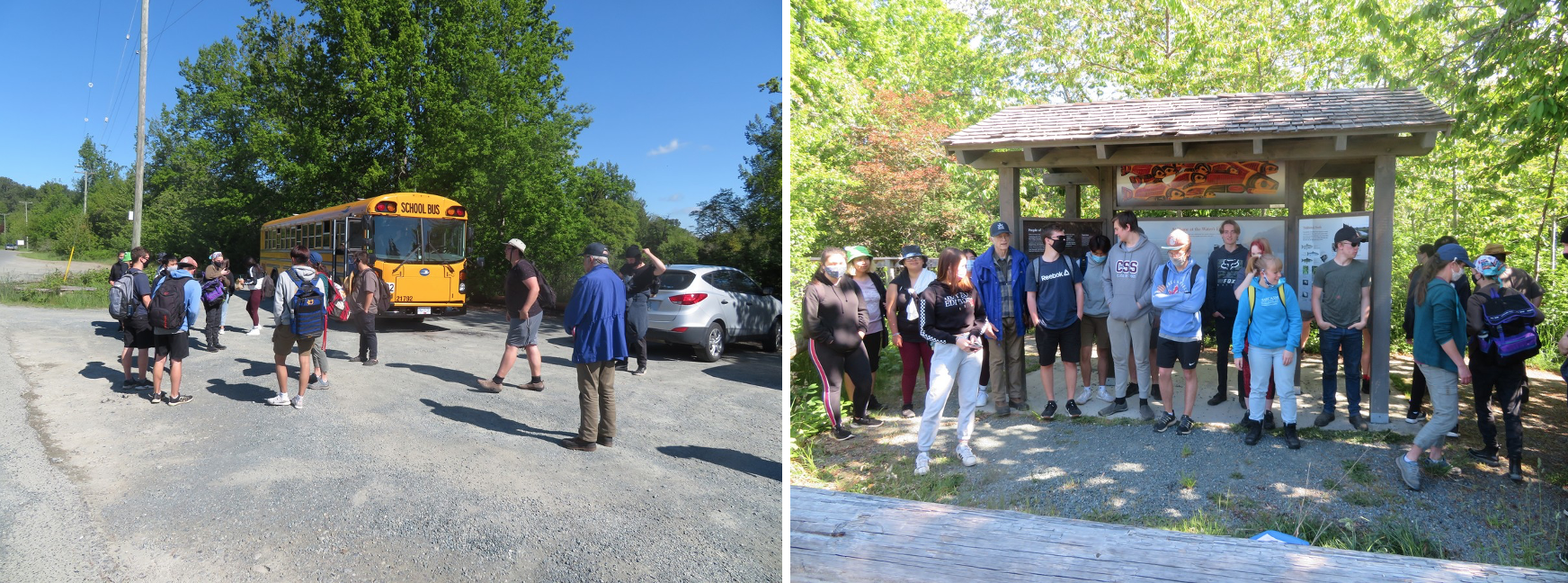
The grade 11 and 12 students from Cowichan Secondary School at the trailhead of CERCA's self-guided nature trail.
Geoff lecturing at the open air classroom, a platform along the trail (left photo). Goetz explaining the reason for breaching the dyke and access road, in order to re-connect the two parts of the estuary that were effectively cut in half by the artificial dyke (in-filled former railroad bed) for which disrupted proper estuarine ecosystem functioning for many decades.
Bill, Joanna VeraFlores and John Lofto, the two school teachers in charge of the course, collecting sediment samples from the pebble beach north of the Westcan Terminal, once in May the second time in June (photo below).
Intern Cooperative Program of Cowichan Secondary Students with CERCA
Goetz assumed overall responsibility for a group of five students enrolled in an Intern Cooperative Program with CERCA as part of the Environmental Science and Human Geography Curriculum of Cowichan Secondary School. The Interns worked once per week throughout May and June on CERCA projects in the estuary.
The Internship started with monitoring swallow boxes located along the south fork of the Cowichan River with box numbers clearly visible from the trail. Two students per group recorded swallow activities using the same templates we have used for the past five years. It appeared that in early May eggs had hatched only in two of the seven boxes under observation.
Interpretative signs along the trail constitute a quality educational tool.
Walking along the trail we discussed impacts of invasive species on the estuarine flora and fauna, spent time on species identification, removed broom along the way, and cleared vegetation crowding in on the interpretative signs. At each sign Goetz explained its rationale message for the reader. He also explained the difference between aggressive invasive species such as Himalayan black berry, broom, canary grass and yellow iris in the estuary versus non-aggressive but also non-endemic species which do not pose a threat to our native flora. The latter applies in particular to fruit trees scattered along the trail, brought in accidentally via railroad in the last century.
Swallow box monitoring from the platform and other locations along the trail...
Another activity involved broom removal from the spit at the end of the Western Forest Products Mill Pond. Goetz used the opportunity to explain and discuss impacts of grounding out log booms in the inter-tidal area, log transport via the transport channel to the mill pond, the periodic dredging of the log transport channel and the mouth of the mill pond removing gravel deposited by the North Fork of the Cowichan River, and the associated partly severe impacts on the ecological integrity of the estuary.
The spit running parallel to the Mill Pond and extending into the estuarine inter-tidal zone had been cleared of broom by CERCA volunteers two years ago. It was amazing to see how much broom has invaded the area again within two years, presumably grown from seeds surviving in the soil for many years.
The last weekly event of the Intern Program was spent on Mariners Island, CERCA's showcase of a rehabilitated salt marsh. You may recall that in 2016 CERCA in cooperation with Western Forest Products, Ducks Unlimited, and with funding from DFO, removed thousands of logs from the Island. Logs washed up over decades had formed a solid layer covering several acres of salt marsh. Following log removal, CERCA jointly with Ducks Unlimited monitored the recovery process which proved to be phenomenal, an indication of ecosystem resilience! It was a rewarding experience for the students to experience first-hand the success of an important restoration project by an Environmental NGO.
Tree stumps and trees with branches transported by the river into the estuary and salt marshes are important habitat features, providing perches for birds of prey and shelter for many creatures. In contrast to saw logs which are swashed around by tides damaging marsh vegetation, tree stumps and trunks with branches are generally firmly anchored in the ground enhancing wildlife habitat as shown by the left photo. The photo to the right shows piles of woody debris in an advanced stage of decomposition at the time of clean-up that was mixed with soil to facilitate rapid colonization by native shrubs and other vegetation, just another important habitat feature!
Unfortunately, we also encountered numerous saw logs which had been washed up again onto the marsh since the clean up in 2016. Those logs are part of log-booms anchored in the inter-tidal area of the estuary prior to being pulled by tug boats into the mill pond for processing. Stray saw logs in the estuary are mostly found after storms. They should be removed before entering the salt marsh where they cause a lot of damage. The left photo shows about 20 saw logs which are most difficult to remove once they settled on the marsh. The lush shrubs growing on the woody debris pile on the right are a sign of a successful habitat enhancement measure.
Stray saw logs found along the edges of salt marshes as shown by the photos above, can still are pulled off at high tide by tug boats. Regular monitoring for early discovery and removal of such logs is therefore very important. It is the responsibility of Western Forest Products to stay on top of it...
Judging by the feed-back from Cowichan Secondary School, it appears that cooperation with CERCA and exposure to our project was a very welcome and successful learning experience for the students involved. We are currently discussing whether we would like to continue with this program in the fall term.
Dr. Goetz Schuerholz
Chair CERCA
June 2021


